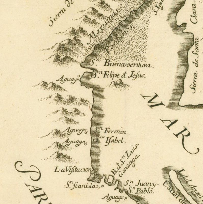
Hmmmm. 1860's? That would sort of make sense, because it does not show Real del Castillo, a town that became the capital of the northern territory
of Baja in 1872. So that makes it pre-1872. No self-respecting cartographer would leave out the capital.
On the other hand, there are a couple of odd things. For one it uses the modern spelling of Tijuana. In the 1860's it was Rancho Tia Juana, a tiny
ranch hardly even worth noting on a map. It was not until 1874 that a customs house was established at Rancho Tia Juana to levy customs duties on
miners that were going to Real del Castillo and it became a "place". Not sure when it became known as Tijuana, but it was after then.
Also, shows a trail from Mission Santa Maria to San Felipe. As far as I know there was no such trail, ever. ?? Even if it meant to show the trail
from Puertecitos to Gonzaga I do not think such a trail existed in the 1880s, at least one that was in general use. That trip was considered a
life-threatening journey until after 1900, and seldom attempted by land. Back then, the few travelers to the Calamjue / Gonzaga coastline would make
the trip on a steamship or sailing vessel or from the west off the old mission trail, not from San Felipe.
And what was "Santa Isabel"? south of San Felipe. The lost mission?
Bit of a mystery. Perhaps a map drawn later to show early Baja? These are my thoughts. |


 by
by